English
  Romana
Garmin GPS Montana 680t + Romania Map + Europe Topographic Map

Price: € 530
Check Availability
Discover the benefits of shopping with us!
Enjoy free shipping on all orders over 500 lei.* Choose to enjoy your favorite products without any extra shipping costs.
We also accept shopping card payments, giving you the option to pay in equal installments, without interest, for a worry-free shopping experience.

*Additional charges may apply for some orders. See delivery policy for details.


Product Description
Product Description Garmin GPS Montana 680t + Romania Map + Europe Topographic Map
From navigating lakes or waterways on your boat, trekking through the backcountry, cruising on your ATV, geocaching or receiving turn-by-turn directions to the grocery store, Montana 680t has the mapping and versatility to handle what you need it to do. Featuring an updated 8MP camera for high-quality geotagged photos, a preloaded Recreational Map of Europe a preloaded Recreational Map of Europe, GLONASS support for improved positioning and quicker fixes, as well as 250,000 preloaded geocaches and storage capacity for millions more. The Montana 680t has a ruggedized design with multiple mounting and battery options, and support for a wide range of Garmin cartography, including a free subscription to BirdsEye Satellite Imagery.
The handheld GPS to go anywhere and everywhere
- GPS and GLONASS - faster and better satellite fix
- 4" outdoor optimised, dual orientation display - best visibility on Garmin's largest handheld display, for easy readability under any condition
- Comes with great content preinstalled - Recreational Map of Europe, 250k geocaches from Geocaching.com and 1 year free BirdsEye Satellite Imagery¹
- Adds new Track Manager for better user experience and more control
- 8MP camera - for high resolution geotagged pictures
- Most versatile navigation everywhere - most versatile features, display and mounting
- Barometric altimeter and 3-axis compass
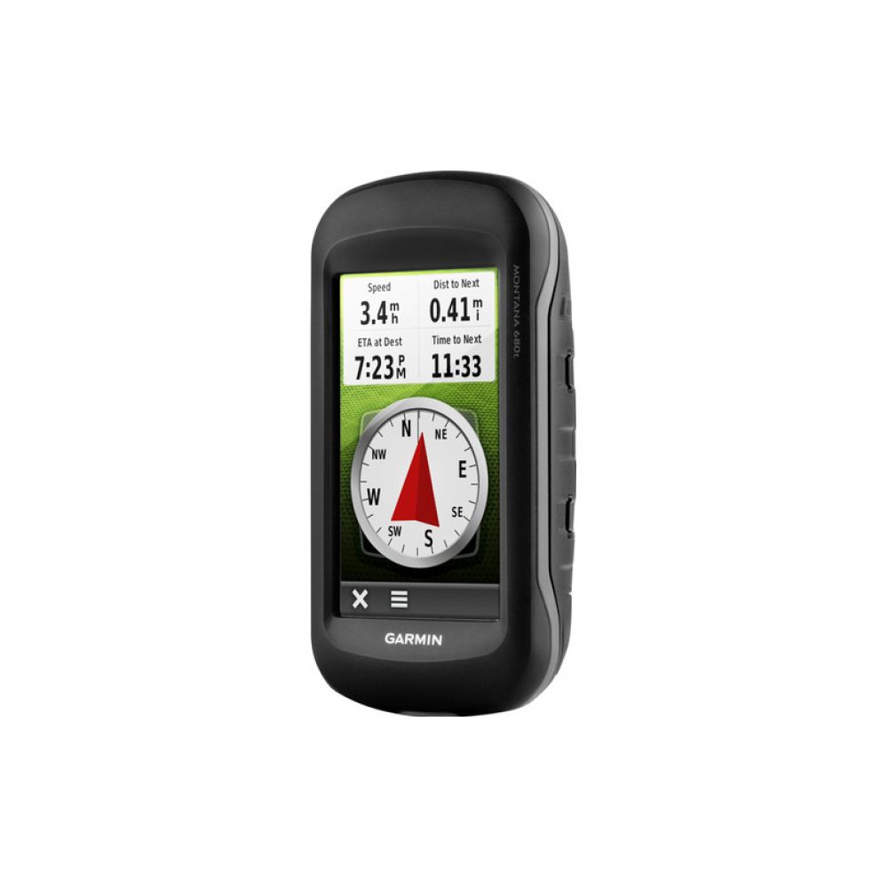
Designed for use on the trail, on road or on the water, the Montana 680t from Garmin will guide you wherever you go. With a vast 4" sunlight-readable touchscreen that offers crystal clear enhanced colours, dual orientation display and GPS and GLONASS positioning to track your location quicker and more accurately, even in the most challenging environment. It's easy to see where you are at all times and conveniently control your track recording with the new Track Manager. Montana 680t includes a 3-axis electronic compass with barometric altimeter and comes with a Recreational Map of Europe and a free 1-year BirdsEye Satellite Imagery subscription¹. Both durable and waterproof, Montana 680t adds a 8MP camera and is built to withstand the elements².
See the Big View
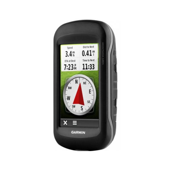
Montana 680t features a 4" outdoor optimised, dual orientation touchscreen display that offers best readability under any light condition. The easy-to-use touch screen user interface means you'll spend more time enjoying the outdoors and less time searching for information. Adventurers love the extra-large display of Montana that provides great readability due to big data fields and clearly visible map features. Both durable and water resistant, Montana 680t is built to withstand the elements. Bumps, dust, dirt, humidity and water are no match for this rugged navigator².
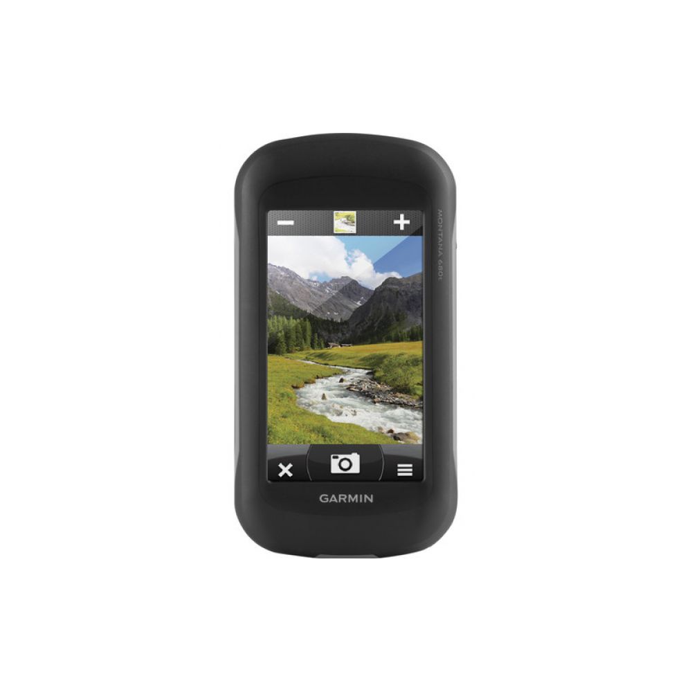
Take Geotagged Pictures
Capture locations and memories with Montana 680t's upgraded 8 megapixel digital camera. Each photo is geotagged automatically with the location of where it was taken, allowing you to navigate back to that exact spot in the future. Snap and view pictures in landscape or portrait orientation. Keep track of your photos and see their locations on a map using BaseCamp™. Insert a microSD™ card for more photo storage or to view pictures from other devices.
Keep Your Fix
With the new high-sensitivity GPS and GLONASS receiver, Montana 680t locates your position quickly and precisely and maintains its location even in thick forest and deep valleys. The advantage is clear - whether you're under heavy tree cover or just near tall buildings and trees, you can count on Montana 680t to help you find your way when you need it the most.
Go Anywhere
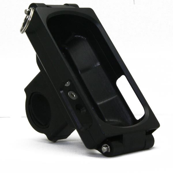
With an array of compatible mounts, Montana is designed for use on bicycles, in 4x4s, on boats and as a handheld or for convenient everyday navigation in your car. Use the optional auto mount with City Navigator maps for spoken, turn-by-turn driving directions, or try out the optional rugged mount for your motorcycle or ATV.
Go Everywhere
Montana 680t comes preloaded with a Recreational Map Europe and a free 1-year BirdsEye Satellite Imagery subscription for great aerial images to enhance your navigation, in case you want more detailed information adding more maps to Montana is easy1. Load TOPO maps and hit the trail, plug in BlueChart® g2 preloaded cards for a great day on the water, or load City Navigator map data for turn-by-turn driving directions. Or, transform paper maps into files you can download to your Montana with Custom Maps.
Navigate with Ease
The new Montana 680t features a Track Manager app that allows you to record, view and analyse your tracks in a very convenient and intuitive way. The handheld has key features for the outdoors such as a 3-axis tilt-compensated compass which shows your heading even when you're still, without holding it level. It also has a barometric altimeter which tracks changes in pressure to pinpoint your precise altitude, and you can even use it to plot barometric pressure over time, which can help you keep an eye on changing weather conditions.
Find Fun
Montana 680t comes preloaded with 250,000+ assorted geocaches from geocaching.com and supports paperless geocaching. This allows Montana 680t to store and displays key cache information, including location, terrain, difficulty, hints and descriptions, which means no more manually entering coordinates and paper print outs. Once you want to add more caches simply upload the GPX file to your device and keep the hunt going.
Share Wirelessly from device to device with ANT+
With Montana 680t you can share your waypoints, tracks, routes and geocaches wirelessly via ANT+ with other compatible Garmin GPS users. Simply press "Send" to transfer your information to other units.
Double Your Power
Montana 680t features the Garmin dual battery system that guarantees a maximum of independence. You'll have the option of using the rechargeable lithium-ion battery pack or traditional AA alkaline batteries - whichever suits you best.
Plan Your Next Trip
Take charge of your next adventure with our free BaseCamp™, software that lets you view and organise maps, waypoints, routes, and tracks. This free trip-planning software even allows you to create Garmin Adventures that you can share with friends, family or fellow explorers. BaseCamp displays topographic map data in 2-D or 3-D on your computer screen, including contour lines and elevation profiles. It also can transfer an almost unlimited amount of satellite images to your device from the included BirdsEye Satellite Imagery subscription.
Features
New Track Manager
- Advanced Shortcut Features
The new Track Manager allows you to organise and navigate through waypoints, routes and track logs with ease and also provides great control over start/stop track recording. - 8 Megapixel Camera
Includes an 8 Megapixel digital camera which allows you to take images in landscape and portrait orientation. Each photo is geotagged automatically with the location of where it was taken, allowing you to navigate to that exact spot in the future. - Advanced Shortcut Features
Whether it's loading an application, navigating to a waypoint, switching your profile or customising specific settings to your needs, advanced shortcuts lets you combine these functions to create a custom-tailored, streamlined experience. Each Montana comes with pre-loaded shortcuts - Go Home, Track Log On/Off and Stop Navigation - to get you started. - More Dashboards in More Places
With 1 touch of the power button, you can pull up a multi-orientation dashboard from anywhere - your map, home screen, compass, trip computer, status page and more - so you can create more dashboards in more places. - Fully Customisable Homescreen
Whether you go somewhere often, continually change settings or create shortcuts, Montana's fully customisable home screen allows you to bring up to 16 items from "Where To?," "Setup" and "Shortcuts" to your home screen so you can easily access them without having to click between screens. - Reorderable Menu Options
Reorder any menu however you like with this new feature, which keeps you from constantly scrolling to the bottom of a long list. - Smarter Profiles
Montana's smarter profiles feature remembers which profile you were using, based on the mount, so when you're off-roading or trying to find a bike shop, it will put you in the right frame of mind so you can get you on your way quickly. - Adaptable Controls
Montana's smarter profiles feature remembers which profile you Don't like the way something is set up? No worries. With a tap of a button, you can configure your applications easily and quickly with adaptable controls. Have to mount on the right handle bar? No problem. Montana can accommodate left- or right-handed setups based on the screen orientation.
Reviews
Reviews for Garmin GPS Montana 680t + Romania Map + Europe Topographic Map
At the moment this product has no reviews
Questions and Answers
Questions and Answers Garmin GPS Montana 680t + Romania Map + Europe Topographic Map
No questions listed for this product at this time
About Garmin
Garmin este un brand american de produse electronice, specializat in productia si comercializarea de dispozitive GPS, ceasuri inteligente, camere de actiune si alte produse electronice pentru sport, aviatie, navigatie, marina, outdoor si alte industrii.
Garmin a fost fondata in 1989 si a fost unul dintre primii producatori de dispozitive GPS comerciale. Compania si-a extins ulterior portofoliul de produse, adaugand dispozitive pentru sportivi, cum ar fi ceasuri inteligente, monitoare de activitate si camere de actiune. Produsele Garmin sunt utilizate de sportivi profesionisti si amatori, de piloti si de oameni de afaceri din intreaga lume.
Garmin este recunoscuta pentru calitatea si fiabilitatea produselor sale, oferind solutii inovatoare si avansate tehnologic pentru a ajuta utilizatorii sa-si imbunatateasca performantele si sa-si atinga obiectivele. Compania are o prezenta globala si este lider de piata in multe dintre industriile in care activeaza.
Nu gasesti o piesa? ai nevoie de ajutor?
Similar Products
-
Rost Offroad GPS Etrex Garmin 10-20-30-X Support
Special Price -5%From € 132
€ 140 -
Rost Offroad GPS Bracket Garmin Etrex Touch 35
Special Price -5%From € 132
€ 140 -
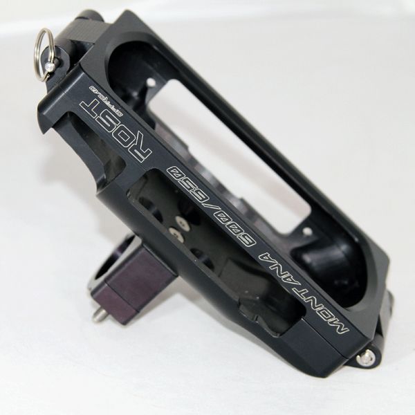
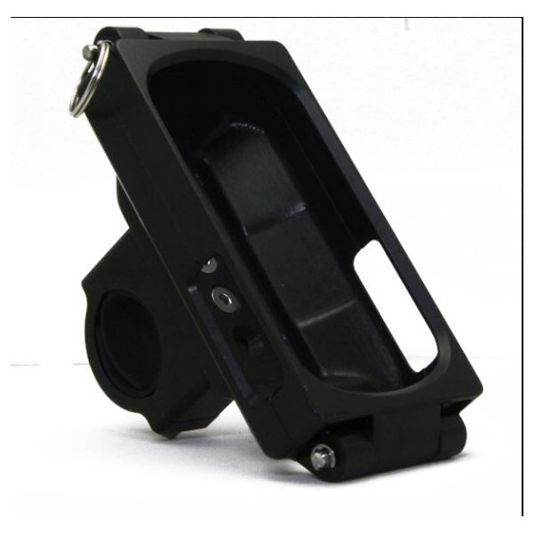
Rost Offroad GPS Montana 600/650 Bracket
€ 217
-
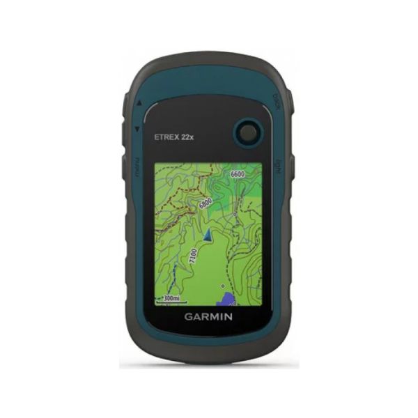
Garmin GPS eTrex 22X
€ 232
-
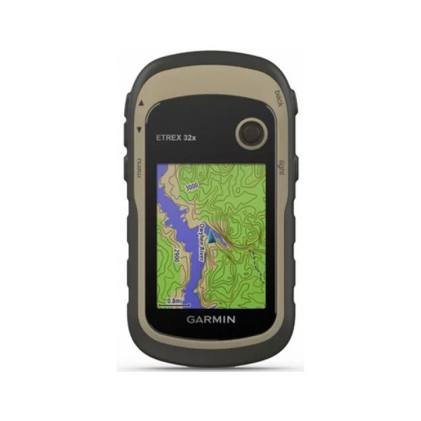
Garmin GPS etrex 32X with Romanias Topographic Map Included
€ 282
-
Garmin GPS Montana 680t + Romania Map + Europe Topographic Map
€ 530
 KTM OEM parts-gear
 Husqvarna OEM parts-gear